

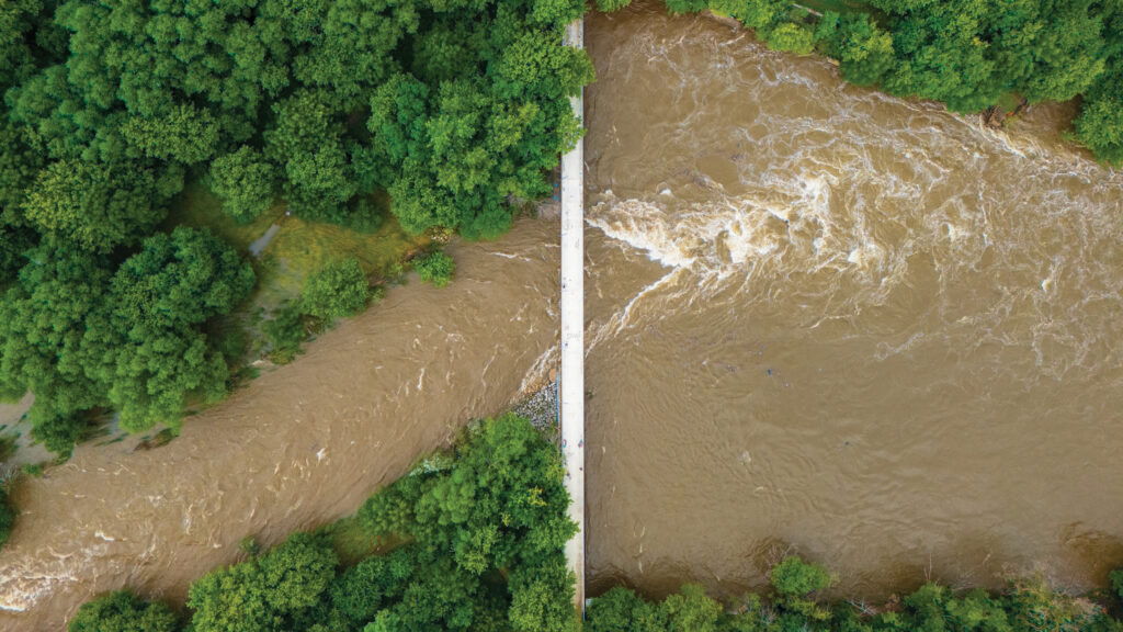
On a spring morning in Mequon, Kristin Schultheis pauses every few steps along the banks of Little Menomonee Creek. Most people would see a flooded landscape still recovering, weeks after April’s storms – the region’s second severe flooding incident in eight months. Schultheis sees something else entirely.
She notices the dark, nearly black soil beneath her boots, rich with centuries of accumulated carbon. She points to a groundwater-fed spring bubbling from a nearby calcareous fen. Native prairie grasses sway overhead, their roots stretching deep underground. Crawfish burrows dot the landscape farther inland than expected. Nearby, the remains of a beaver dam torn apart by floodwaters lie scattered.
Evidence of the flood’s power remains everywhere. Debris hangs from tree branches. Fresh channels carved into the earth reveal where water spilled over the banks from the creek and spread across the property.

Check It Out!
To an outside observer, the scene might look like destruction. To Schultheis, a senior project planner with the Milwaukee Metropolitan Sewerage District, it looks like success.
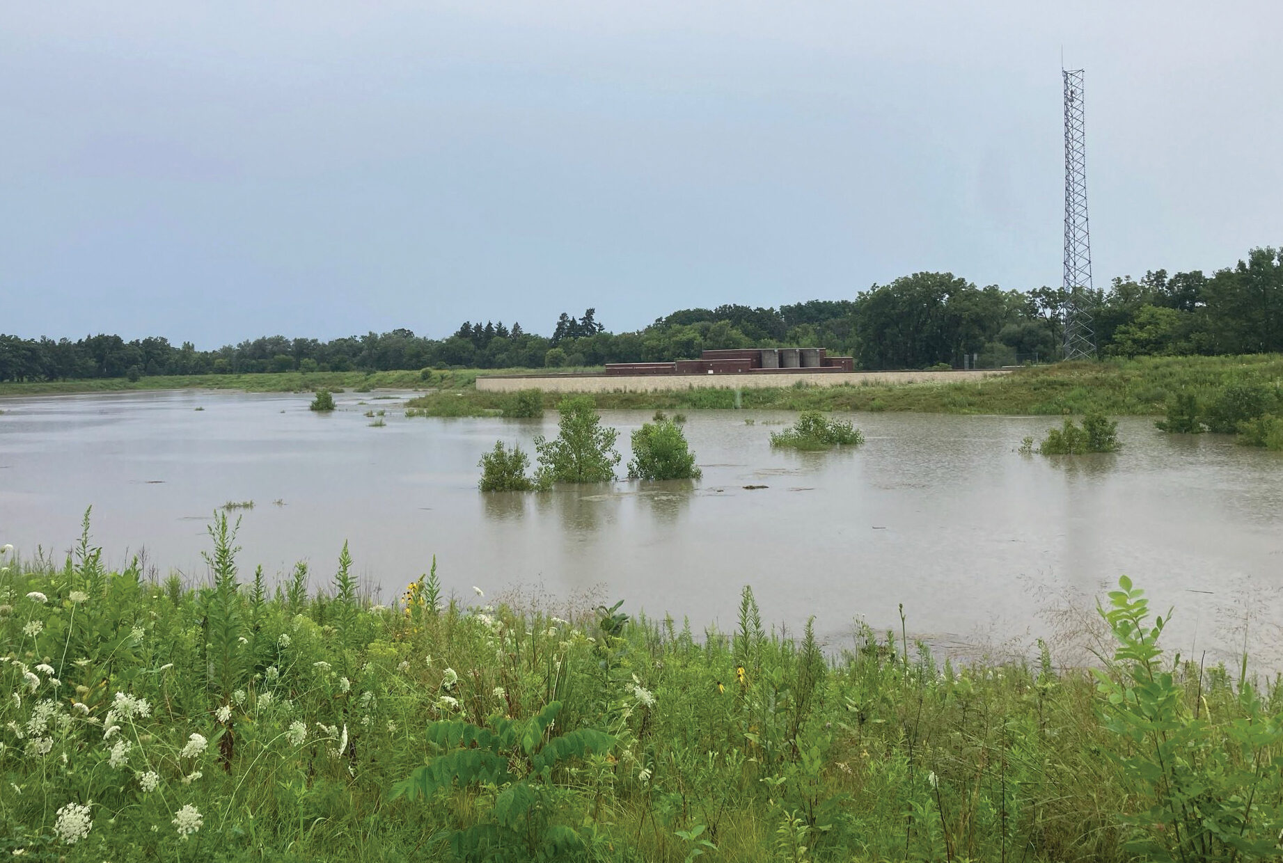
The water left the creek; it was bound to, with 4 to 5 inches of rain courtesy of consecutive days of severe storms. But instead of all rushing down the river, it spread into the nature preserve’s surrounding floodplains and low-lying areas designed to absorb and hold it in place.
The Hoerig property, a former farm preserved and “rewilded” through MMSD’s Greenseams program, illustrates one of the most important realities of modern flood management: Water needs somewhere to go.
That lesson is becoming increasingly important across a Wisconsin that’s become both warmer and wetter over the past several decades. The result is not necessarily more storms, but bigger storms, capable of dumping enormous amounts of rain in a matter of hours.
For centuries, Southeastern Wisconsin’s wetlands, prairies, forests and floodplains acted like natural storage systems, slowing water and allowing it to soak into the ground. However, as development expanded, many of those landscapes were hardened and replaced with roads, rooftops, parking lots and other rigid surfaces that shed water instead of absorbing it.
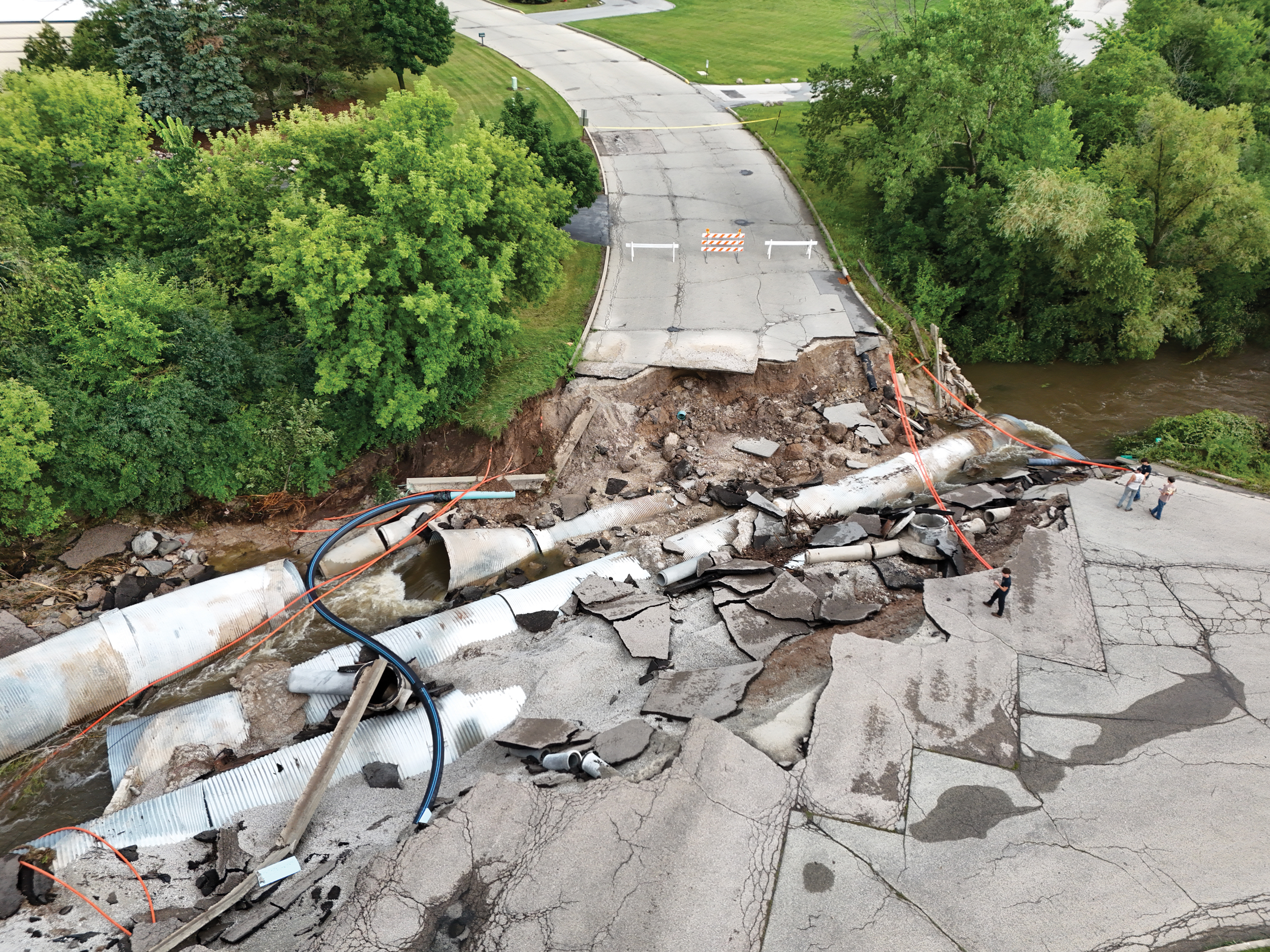
“The hydrology of this land has changed so much from when it was mostly wetlands in the 1800s,” Schultheis says. “The maps show wetland, wetland, beaver dam, beaver dam and much of that, which was good for storing and slowing water, is gone. We’re north of the county line right now, and everything we do or don’t do for storage up here helps or hurts downstream because all of this water is going to go under the Hoan Bridge into Lake Michigan.”
Almost all of the Milwaukee area’s sewers, drains, creeks and rivers feed into the center of the city, picking up every runoff drop of water from southern Fond du Lac and northern Ozaukee counties to West Allis to Cudahy. Because of previous stormwater management methods that relied on moving the water as quickly as possible, that has created flooding and sewer backups for residents, especially when the large storms arrive.
That’s why, as climate change delivers heavier rainfalls and more volatile weather, MMSD is increasingly investing in projects that work with nature rather than against it – preserving land, restoring rivers, reconnecting floodplains and creating space for water to spread out safely.
Near the creek, Schultheis scoops up a handful of soil from the former farmland and lets it crumble through her fingers. She looks across the creek to the far side. The water is a little too high to cross today, but there, she sees less-farmed wetland soil that’s almost black from the carbon of degraded plant material. When rains come, it acts like a sponge. If we want to manage the water throughout all communities, here and Downtown, it’s going to take natural solutions, she says.
“This parcel was slated for I don’t remember how many homes,” Schultheis says. “But the owner wanted it preserved. There’s a place where conservation and development can coexist, and a lot of people don’t believe that that can happen, but we clearly are seeing it here. Working with the land, working with Mother Nature couldn’t be more important right now.”
The Climate Factor
The Wisconsin State Climatology Office has documented a steady increase in heavy rainfall events since the late 1800s. In 2024, Wisconsin experienced its warmest year on record. As greenhouse gases warm the atmosphere, the air can hold more moisture. When storms develop, that moisture can be released all at once.
“When conditions are right for a heavy rainfall like they were in Milwaukee last August,” says Steve Vavrus of the Wisconsin State Climatology Office, “we can just wring out more moisture from the atmosphere and pile up a lot more rainfall than we used to.”
That Aug. 9, 2025, storm dumped 14.55 inches of rain on Milwaukee, the largest recorded rainfall in state history – by a lot. On June 24, 1946, 11.72 inches of rain fell in Mellen, in Ashland County. Of the seven highest single-day rain records, five were recorded in Southeastern Wisconsin on Aug. 9.
Making Room for Water
It’s a simple scientific fact: The warmer air is, the more moisture it can hold. It’s why wetter weather comes with Wisconsin’s warming climate. “The Milwaukee event last summer was really an exclamation point on a long-term trend we’ve seen toward more extreme rainfalls,” says Steve Vavrus of the Wisconsin State Climatology Office.
The night of Aug. 9 recorded four of the highest single-day rain events in Wisconsin history. More than 11 inches of rain was recorded in three different spots in Waukesha County. In parts of Milwaukee, as much as 14.55 inches fell, besting a record set nearly 80 years earlier, in 1946.
That so-called “1,000-year flood” – weather so severe that it has a 0.1% chance of happening in any given year – exposed a reality across Southeastern Wisconsin: Much of the region’s infrastructure was never designed to manage so much water.
For decades, MMSD’s stormwater strategy centered on moving water away as quickly as possible. At the heart of that system sits the Deep Tunnel, a 521-million-gallon network built in the early 1990s following the federal Clean Water Act. The tunnel collects wastewater and stormwater from 29 municipalities before sending it to treatment facilities at Jones Island and South Shore.
On an average day, those facilities treat roughly 65 million to 70 million gallons of water. During major storms, Jones Island can process as much as 390 million gallons daily. But even a system of that scale has limits.
When the Deep Tunnel nears capacity, MMSD faces a difficult choice: allow sewage to back up into homes and businesses, or release untreated water into Lake Michigan.
During April’s flooding, the tunnel reached capacity and MMSD released 2.7 billion gallons of untreated waste- and stormwater to prevent more widespread backups throughout the region. It was the third-largest discharge since the tunnel’s construction. The largest, 5.14 billion gallons, came just months earlier in August’s record-breaking storm. It’s a growing issue that has spurred MMSD to reimagine its stormwater management over the last nearly three decades.
The turning point came after devastating floods in 1997 and 1998. One June 1997 storm left portions of Interstate 43 under 12 feet of water, flooded County Stadium and caused a massive sinkhole outside the Harley-Davidson plant. The damage stretched across homes, businesses and public infrastructure.
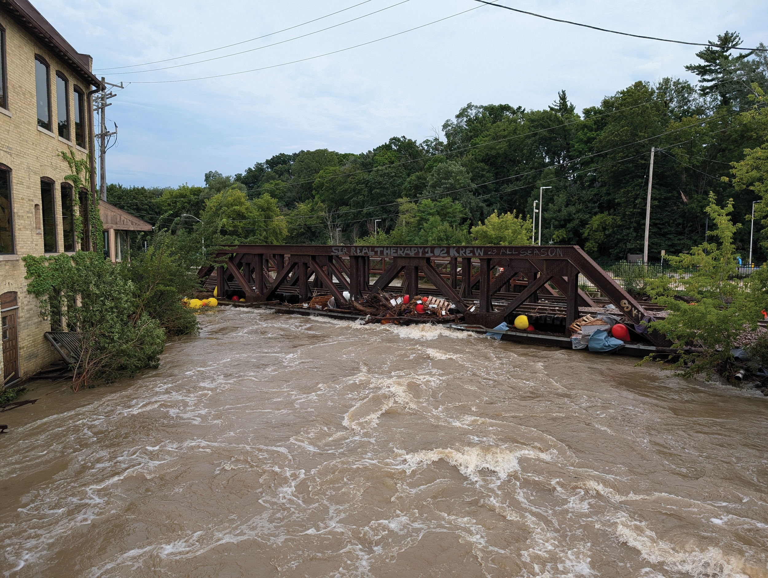
When Kevin Shafer joined MMSD in 1998 as head of engineering, before becoming executive director in 2002, he inherited a challenge far larger than upgrading pipes. The district needed a new way to manage water. The answer was simple: Keep more water on the landscape and out of the sewer system. Since then, MMSD has invested more than $600 million in flood management projects designed to slow, store and absorb water before it reaches rivers, sewers and treatment plants. Another $900 million is planned for future work.
One of the earliest examples was Hart Park in Wauwatosa. Following repeated flooding, approximately 70 homes were purchased and removed from that flood-prone bend in the Menomonee River. By 2005, the neighborhood had been transformed into parkland and flood-storage space in a $48 million project.
Elsewhere, MMSD began creating large-scale water storage areas across the watershed. At County Grounds Park a bit further up the Menomonee, a large basin is capable of holding 315 million gallons of would-be floodwater during major storms. During August’s record rainfall, the basin helped reduce flooding impacts downstream, including in hard-hit downtown Wauwatosa.
Valley Park, along the Menomonee near American Family Field, was one of MMSD’s first river restoration projects. It removed concrete channels and replaced them with a more natural river system paired with an earthen levee and concrete floodwall to help protect 133 homes from floods. Eighteen homes were acquired for that project.
These multi-million-dollar projects, covering thousands of acres, have helped mitigate damage, but as storms grow stronger, communities are still bearing the brunt of a changing climate that shows no signs of slowing with flooded basements and sewer backups. No infrastructure investment can remove flooding from the equation entirely, and the damage remains significant. The August storm triggered FEMA’s second-largest disaster payout in 2025, trailing only the California wildfires.
MMSD’s project list signals progress, but for many Milwaukee neighborhoods, relief remains years away.
From Hazard to Community Asset
On Aug. 10, 2025, Esperanza Gutierrez followed a routine she had kept for years. Early that morning, she left her home across from Pulaski Park in the predawn gloom to pick up a friend for their weekly stroll along the lakefront. As she drove across the 16th Street bridge over the Kinnickinnic River, a roar stopped her in her tracks.
She pulled over and walked to the railing. “It was still dark, but I just saw water, so much water, crashing into the bridge,” Gutierrez says. “I could feel the impact of the water hitting the bridge.”
For the most part, water remained in the channel. There was a section along Harrison Avenue between 16th and Sixth streets that hugged the river that had water in the road and even some abandoned cars. However, it was a much different, less destructive picture than two decades ago when Gutierrez first moved to the neighborhood.
She arrived just as MMSD was first approaching the community like it did in Wauwatosa. Years ago, about 75 homes were on those banks that flooded last August. Gutierrez recalled neighbors – homeowners and renters – dealing with mold and unsafe basements and foundations due to constant flooding.
MMSD purchased the homes over the ensuing years. Residents were given $25,000 for moving expenses on top of their assessments. It took years for all the owners to sell, and some renters, according to neighbors, received nothing. Eventually, the homes were razed.
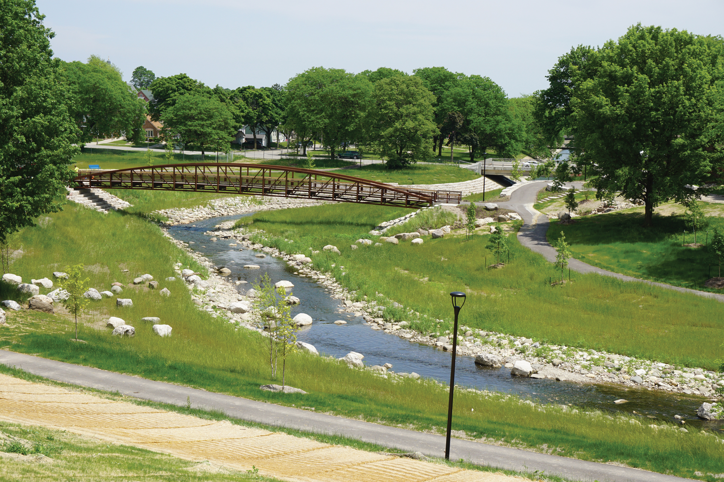
More than 1,700 feet of concrete channel was removed, and the river was widened. The naturalized channel and wide catch basin hold and slow down water as it comes from upstream. The KK now meanders through its eastward bend and natural riverbed; frogs and crayfish have returned to the river, and fish, too. Anglers are occasionally seen on its banks.
But the space was also reimagined with input from the community to become one of Milwaukee’s most beautiful and heavily used parks. There are futsal and basketball courts, a soccer field, and a playground. Residents view the park as a community asset now, both from recreational and flood-mitigation standpoints. However, Pulaski Park is only one part of a much larger effort along the KK river watershed.
Travis Hope has lived in the neighborhood since 2018, but his work with Pulaski Park dates to 2014, when he joined a group called the Kinnickinnic River Neighbors in Action, of which Gutierrez is also a member. Hope became its volunteer president in 2016.
The group has been a community liaison for MMSD as the Pulaski Park project has unfolded. Additionally, members have acted as community educators and connectors, including teaching neighbors about the park, how to become part of the solution and helping people prepare for storms.
“When you get this amount of water, though, there still might be flooding no matter what,” Hope says. “That’s why it’s so important for people to be prepared. We need the city to say more than, ‘Stock up enough water for a few days.’ That’s not gonna do nothing for nobody. We don’t want to scare people, but we need them to be prepared.”
Most of all, the neighborhood has become safer. Hope grew up on the South Side and says he knew someone who drowned in the KK’s concrete channels. More recently, in June 2022, a boy attempted to retrieve his soccer ball that had gone into a rainwater-filled concrete drainage ditch. The boy fell in and his father and a family friend jumped in to rescue him. All three drowned.
Water still rushes swiftly down the river portions still lined with concrete. During storms, it can move objects 20 feet per second with a pressure of 400 to 500 pounds. MMSD has fenced the dangerous zones, and alongside MMSD, Neighbors in Action has helped install safeguards like two WaterMarks, solar-powered devices that light up to alert residents when rain bringing risk of flooding is forecast.
Hope notes the Kinnickinnic has only been naturalized for a short stretch in the neighborhood. Still, he says, “things would’ve been, in August and April, much worse if we did nothing.”
Gutierrez and Hope see the progress as a demonstration of what is possible when engineering is paired with community involvement and long-term investment. The challenge, they say, is ensuring that more neighborhoods receive the same opportunity.
“People have come from other states and even internationally to see how well the project works,” Gutierrez says. “We talk to them about how it helps the community and the part we played in it. We hope it’s an example not just for them, but for Milwaukee’s other neighborhoods that need this community asset, too.”
Waiting for Relief
The disaster announced itself with a burble.
As rain hammered Milwaukee on Aug. 9, Andi Coolman and her husband paced their home on the Kinnickinnic River Parkway on high alert. Text messages flew between Jackson Park neighbors as they watched the river rise. Sewer work completed earlier that year had left residents concerned about backups and clogged storm drains, but the Coolmans had avoided major problems.
Then Coolman heard it. “I go downstairs and the sewer is bubbling up like a fountain,” she recalls.
Their basement wasn’t just storage space. Their 20-year-old daughter lived there, with a bedroom, bathroom and much of her belongings. Laundry, family keepsakes and years of possessions were also down there.
Coolman rushed into action, calling for her husband as sewage poured into the basement. They salvaged what they could before the rising water and electrical hazards forced them out. “We had never had to do this before,” Coolman says. “My daughter lost her room, her [stuff], her memories.” Five hours later, the rain stopped and the damage assessment began.
The river had risen to the family’s front door. Water filled the street knee-deep. A new car sitting in the driveway was totaled. Much of the basement’s contents ended up piled along the curb.
The financial toll was staggering. Because the damage was classified as a sewer backup, the family received no insurance coverage for much of the basement loss. FEMA assistance helped but covered only a fraction of their total losses. Between repairs, mitigation work and damaged belongings, Coolman estimates losses between $50,000 and $55,000, not including the car, which was covered by insurance.
“It was a tough lesson learned,” she says. “We now have a sewer backup rider and flood insurance. I hope we never have to use it, but after what happened, I think you need it.”
While communities such as Pulaski Park have benefited from major flood-mitigation projects, Jackson Park, just to the west, remains one of several neighborhoods where larger-scale improvements are still in the planning stages. MMSD has identified the area as a priority for years. Shafer says the district expects to begin the estimated $70 million Jackson Park project in early 2027, with construction lasting two to three years.
Until then, residents continue living with uncertainty every time severe weather appears in the forecast. That anxiety has become increasingly common across Milwaukee-area neighborhoods vulnerable to flooding. Extreme rainfall events that once seemed rare are becoming more frequent, exposing weaknesses in aging infrastructure and leaving families with financial and emotional burdens long after floodwaters recede.
Yet residents of the South Side and in areas across the city also point to the strength of the community that emerged in the aftermath. Neighbors helped neighbors clean out flooded basements. Contractors volunteered time and shared resources. Community organizations provided food and assistance. Residents exchanged information, checked on elderly homeowners and even worked together to prevent flood victims from being overcharged by opportunistic contractors.
The response revealed a city determined to recover. But resilience alone cannot be the long-term solution.
Jen Nepper, president of the Jackson Park Community Association, found a foot of water in her basement south of the KK during last August’s storm. The experience left lasting scars.
“The trauma and the aftermath is real,” Nepper says. “In April, every hour I was checking to see if the basement flooded. I didn’t sleep during those storms. It’s a financial burden, it’s emotional, and you feel helpless.”
Despite the fears, Nepper’s home avoided a second disaster in April. So did the Coolmans, even as plastic storage bins still fill rooms and their garage. Their daughter moved into their son’s room. Their son now sleeps in his parents’ room.
“I stayed up every night checking the basement when those storms came in April,” Coolman says. “If it flooded again, I would’ve sold the house. Financially, it would be devastating. Emotionally, we’re tired. I love this city. I love my community. But things need to change.”
What Comes Next?
MMSD’s flood management roadmap stretches through 2035, outlining hundreds of millions of dollars in projects designed to reduce flooding across the region, including four of the basins like Jackson Park.
That project has been fast-tracked and will be completed sooner than originally planned, Shafer says. A basin planned for the Northwest Side near 35th Street and Capitol Drive is ahead of Jackson Park. Another at Alro Steel on Sixth Street and I-43 is complete but still needs to be connected to the river system. The last, Wilson Park, is still in discussions.
“You have to build the storage first before you remove the channels downstream because you don’t want to induce flooding,” Shafer says. “The biggest funds will go, at least in the near future, toward those basins to provide storage on those waterways, keep [water] out of people’s basements.”
Many of the neighborhoods most vulnerable today will wait years before those improvements arrive. For Iris Gonzalez, that reality highlights a growing challenge that cannot be solved by infrastructure alone.
A local climate justice advocate who advises MMSD on equity and flood resilience, Gonzalez views flooding as more than a water management problem. It is also a question of fairness, access and whose experiences shape the decisions that determine a community’s future.
“Climate change is a magnifier and amplifier of the conditions and outcomes that we experience today,” Gonzalez says. “There’s a lot of data that shows after climate disasters, the income gap is exacerbated. Folks who have resources get more resources, and folks who have less resources get deeper into the hole. It can be easy to invisibilize people after the storm passes and the sun is shining again, but there are still a lot of people that have not recovered.”
Before returning to Wisconsin, Gonzalez spent nearly a decade in Houston, one of the nation’s most flood-prone regions. She experienced firsthand how communities can spend years recovering from storms that disappear from public attention within days. Those lessons now shape how she views Milwaukee’s future.
That pattern emerged during a recent community flood resilience summit Gonzalez helped organize. Residents from across Milwaukee gathered to share their experiences following last year’s storms. Stories from across the city sounded remarkably similar. Some families were still displaced months later. Others continued dealing with recurring basement backups, repair costs and uncertainty every time rain appeared in the forecast. Language barriers, insurance gaps and confusion about available resources often compounded the challenges.
As residents compared experiences, many discovered they shared the same frustrations regardless of where they lived: Recovery was difficult, expensive and often isolating. Finding some sort of solace in community helped in a difficult short term. They hope the collective voice they have will help in the long term.
That is why MMSD launched a community engagement process to create a flood resilience plan. The hope is a shared vision, a process designed by the community, for the community, that puts a structure in place that is beneficial to everyone.
After all, whether the water falls at a former farm in Mequon, or central city neighborhoods like Jackson Park, Pulaski Park or the North Side, it’s going somewhere the people are.
The question facing Southeastern Wisconsin is no longer whether bigger storms are coming. The challenge now is whether the region can create enough room for the water before the next one arrives.
As three men gathered with a group of neighbors in the basement of Progressive Baptist Church on the evening of Aug. 9, requests for help rushed in from neighbors on the city’s Northwest Side. Of all the flooding across Southeastern Wisconsin that day, this neighborhood was hit the hardest. One rain gauge recorded 14.55 inches of rainfall, the most ever recorded in a single day in Wisconsin.
Stories of clogged drains, sewer backups, and flooded basements poured in. Neighbors reported as much as 10 feet of water in their basements and families displaced. No one person could fix that. A community, though?
That was the inspiration for Flood Hope 500, a free, community-based flood response effort created by Vaun Mayes, Montreal Cain and Aziz Abdullah.
“It’s the art of neighboring,” Abdullah says. “What it means to have a safe and cohesive community — it’s possible. This work exemplifies that. People want to help. They want to give back. They just need an opportunity, knowledge and empowerment.”
With four sump pumps secured from a Farm & Fleet in Oconomowoc – the only ones in stock within 40 miles – and a growing list of residents in need, they set out after the flooding with about 15 people. For the next 48 hours, they worked.
The adults, some of whom came from as far as Eau Claire, volunteered their time to help – working with donations of boots, gloves and other supplies from Black Men Build – but thanks to financial support, the group was able to pay over 30 teenagers to help clean up flooded houses.
As they heard stories, they raised money – with funding help from the United Way, the Greater Milwaukee Foundation, the Milwaukee Brewers Community Foundation and Mental Health America of Wisconsin – and connected residents with local nonprofits and resources. The results: financial, legal, tenant and displacement resources from United Way and the Legal Aid Society of Milwaukee plus education about flooding and mold, delivered right to residents.
“What we’ve become is more about flooding the community with hope than responding to floods,” Abdullah says. “The flood was something we needed to respond to right away, but we need to take what we learned as an application of other issues in the community.”
The group believes effective community response works across five tiers – individual, interpersonal, family, community and policy – and wants their model enacted at the city, county and state levels.
That vision drives their expanding reach. When food stamps were paused during last November’s federal shutdown, they organized food distribution countywide with NourishMKE, Milwaukee’s largest network of food pantries.
Abdullah envisions a formal, community-led response fund – modeled after New York City’s emergency snow-shoveling program, which paid residents $30 per hour to clear bus stops and fire hydrants. Whatever form it takes, he says, the structure can’t wait for the next disaster.
“We know most of the work we need to do,” he says. “We just need to be ready with how we can, and will, respond.”