by Evan Solochek, photos by Michael Olen
A simple Arts and Crafts bungalow – modest yet iconic, vintage yet timeless – sits framed in soft purple. The house looks scrubbed clean and perfect, with its white-railed porch and leaded-glass windows, yet the lavender glows eerily from within the home, and a face seems to peer out from the cartoonish green shrubbery. There’s a touch of magical realism to this image of Franklin Heights, the neighborhood on Milwaukee’s near-North Side.
The poster is one of 27 created by Jan Kotowicz from 1983 through 1990 for the Milwaukee Department of City Development. Her poster for Clarke Square portrays the South Side neighborhood floating above a moody blue sky and silhouetted trees; the Story Hill poster turns the West Side neighborhood into a land of elaborately detailed gingerbread homes ready for a visit from Hansel and Gretel; the Lower East Side feels incandescently Indian, punctuated by the two towering onion domes of the Oriental Theater, pulled from the shadows by a buzzing neon glow.
The posters are small treasures of Milwaukee memorabilia with an interesting history. The project started with funding from the U.S. Department of Housing and Urban Development Community Development Block Grant Program. Both Kotowicz and historian John Gurda, who wrote for the project, point to Greg Coenen as the real driving force behind the series. Coenen, who died in 2008 from lung cancer at the age of 58, was manager of communications for the DCD at the time.
“There was a promotion going on about how to distinguish Milwaukee as a city of neighborhoods,” says Kotowicz, who retired from the DCD early in 2010. “We asked, ‘How could we make each neighborhood know how cool they were?’ Greg came up with the idea.”
“It was a city-building initiative,” says Gurda. “The intent was to promote pride, promote investment – both emotional and financial – and to create resident identification.”
As striking as the art is, the writing is just as evocative. On the back of each poster is a 2,000- to 3,000-word essay about the neighborhood written by Gurda containing then-current events, points of interest and a map outlining the neighborhood’s borders. The local history is almost exhaustively researched.
“I’d have about three weeks to do each neighborhood, which would include historical research, interviewing people and looking at census info from as far back as 1940,” Gurda says. “The last thing I’d do was spend the night bar-hopping. I’d have a beer or two and go in the car and write. It was a challenge but also a lot of fun.”
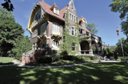
Gurda’s essay on Franklin Heights captures the country-to-city transformation (some residents still remembered a neighbor who raised sheep, pigs and chickens early in the 20th century); its German and Lutheran roots and latter-day settlement by African-Americans, some of whom had lost homes to the east because of freeway construction; the dominant churches and huge influence of nearby A.O. Smith, which drew many workers to live in the neighborhood; and the predominance of bungalows and duplexes.
Even Kotowicz herself was surprised by what she learned from the project. “I always thought I grew up in Bay View. I went to Bay View High School, my heart is in Bay View,” she says. “But once the maps came out, I realized I was actually in Tippecanoe.”
The artist and historian worked closely on the project. They’d pick the neighborhood together, and though Gurda would give Kotowicz a list of candidates for graphics, she was given free rein to choose whatever she wanted. Some were more obvious than others – such as the water tower for Northpoint or the Gesu Church for Marquette. The posters range widely in style, from boldly abstract modernity to slightly surrealist to Disney-like fairy-tale treatment, yet somehow they are all of a piece, creating a unified tapestry of these varied neighborhoods.
After a poster was completed and printed, each address within the neighborhood was mailed one free of charge. “The neighborhood pride they elicited was great,” says Kotowicz. “They didn’t have that sense of identity before.”
However, the development grant ran out in 1990, leaving the series unfinished – areas such as the Third Ward, Menomonee Valley and Lindsey Heights are noticeably absent. For his part, Gurda would like to do another dozen or so and turn the series into a book.
“There were so many neighborhoods left unrepresented,” says Kotowicz. “If there was funding, it’d be great to finish the series.”
Today, the posters have become an indelible part of Milwaukee’s identity and history. And they’re still for sale on the DCD website for a mere $3 a pop.
“More than 27 years later, they still have currency,” Gurda says. “I don’t think there has ever been as comprehensive a collection of information of neighborhoods in Milwaukee.”
Evan Solochek is an associate editor at Milwaukee Magazine.
Write to him at evan.solochek@milwaukeemag.com.